Some trails stick with you long after you’ve left them, not just because they challenged your legs but because they offered something unexpected. Maybe it was the way morning light hit a sandstone cliff, or the sight of a waterfall dropping straight onto a beach, or ancient handprints on a rock wall that made you stop and think about who stood there centuries ago.
The best hikes are a mix of physical movement and visual reward, giving you something to look at that makes the effort worthwhile. These trails across the West offer exactly that, from coastal overlooks to desert dunes, each with its own character and reason to visit.
Contents
- 1 Torrey Pines State Reserve: Majestic Coastal Cliffs and Rare Pines
- 2 Big Sur’s McWay Waterfall Trail: Discover Sandy Beach Waterfalls
- 3 Mishe Mokwa Trail to Sandstone Peak: Conquer Southern California’s Pinnacle
- 4 Ranchos Palos Verdes Shipwreck Hike: Explore Historic Ocean Views
- 5 Bluff Trail on Sonoma Coast: Wildflowers and Dramatic Bluffscapes
- 6 Barker Dam, Joshua Tree: Encounter Iconic Rock Formations and Petroglyphs
- 7 Zion’s Angel’s Landing: Traverse Narrow Ridges for Canyon Vistas
- 8 Sedona’s Brins Mesa Trail: Red Rock Formations at Sunrise and Sunset
- 9 Kelso Dunes, Mojave Preserve: Experience Surreal Shifting Desert Landscapes
Torrey Pines State Reserve: Majestic Coastal Cliffs and Rare Pines
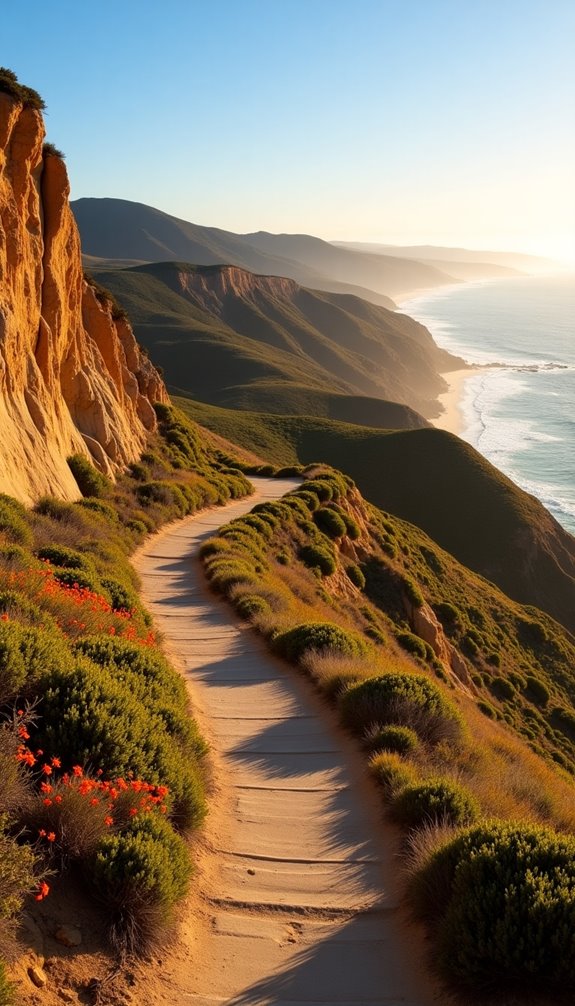
Torrey Pines sits on the California coast north of San Diego, protecting one of the rarest pine species in North America. The Guy Fleming Trail is the easiest option here, looping past two ocean overlooks with wildflowers blooming thick in spring.
Razor Point Trail takes you along dramatic cliff edges where you can watch the ocean far below. The High Point Trail is short but steep, rewarding you with views that stretch from La Jolla to the Laguna Mountains on clear days.
SEE THIS: Feminine Survival Guide to Backpacking in the Wild.
Big Sur’s McWay Waterfall Trail: Discover Sandy Beach Waterfalls
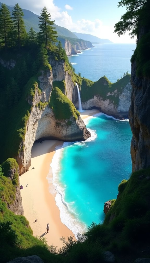
McWay Falls drops 80 feet directly onto the beach at Julia Pfeiffer Burns State Park, creating one of those scenes that doesn’t look quite real. The trail itself is barely over half a mile round trip with almost no elevation gain, making it accessible for almost anyone.
You’ll walk through a tunnel under Highway 1 and then follow a paved path to the overlook. Go in the morning before the parking lot fills up, and you might have the view mostly to yourself.
SEE THIS: 15 Cute & Comfy Summer Hiking Outfits That’ll Make You Want to Hit the Trail ASAP.
Mishe Mokwa Trail to Sandstone Peak: Conquer Southern California’s Pinnacle
Sandstone Peak reaches 3,111 feet, making it the highest point in the Santa Monica Mountains despite its misleading name (it’s actually volcanic rock). The full Mishe Mokwa loop covers about 6 miles with steady climbing, winding through chaparral and past balanced rocks.
You can also take the direct route from the Backbone Trail, which cuts the distance in half but hits you with a steeper grade. On top, you’ll find a plaque honoring W. Herbert Allen and views stretching to the Channel Islands on clear days.
SEE THIS: Hiking Boots vs. Trail Runners: Which Is Right for You This Summer?.
Ranchos Palos Verdes Shipwreck Hike: Explore Historic Ocean Views
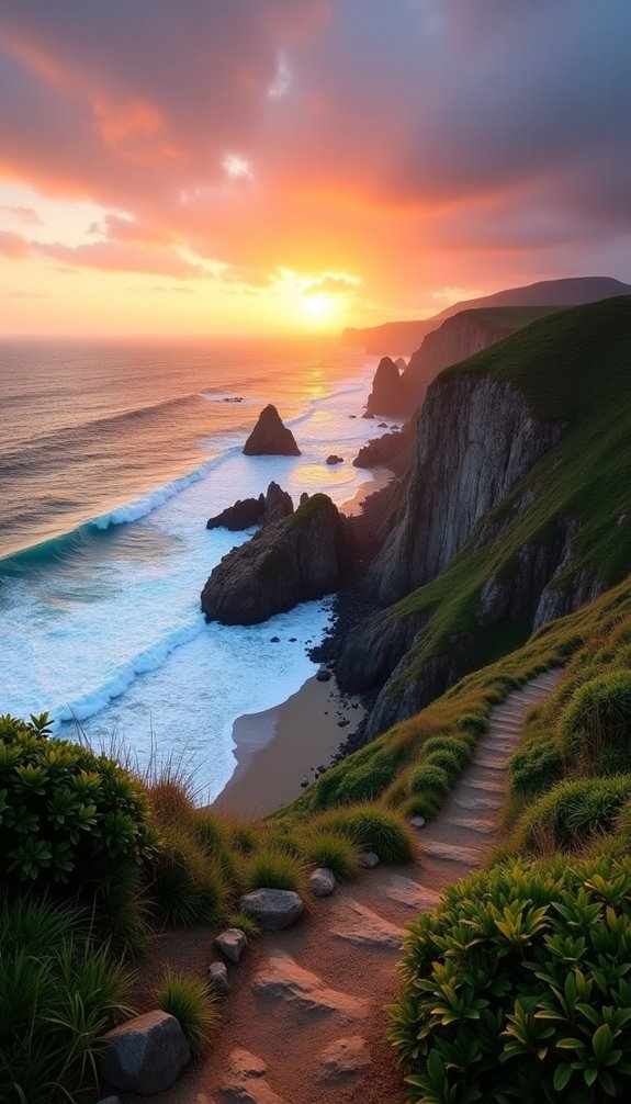
The rusted remains of the SS Dominator have been wedged into the rocks here since 1961, slowly breaking apart in the surf. This isn’t a designated trail so much as a coastal walk along the bluffs near Paseo Del Mar, covering anywhere from 1.5 to 3 miles depending on how far you wander.
At low tide, the tide pools around the wreck come alive with sea stars and anemones. The nearby Point Vicente Lighthouse adds another historic element if you want to extend your exploration.
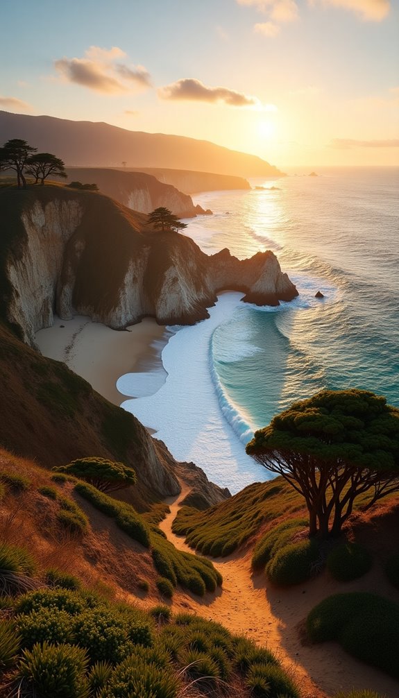
Bluff Trail on Sonoma Coast: Wildflowers and Dramatic Bluffscapes
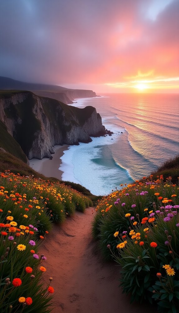
The Bluff Trail starts at Gualala Point Regional Park and follows the clifftops for about three miles above the Pacific. Spring brings California poppies, sea pinks, and western wallflowers that blanket the grasslands in orange, pink, and yellow.
The trail stays relatively flat, but the wind can be fierce, so bring layers even on sunny days. Watch for whales during migration season, and keep an eye on kids and dogs since the cliffs drop off sharply in places.
Barker Dam, Joshua Tree: Encounter Iconic Rock Formations and Petroglyphs
Barker Dam offers an easy 1.1-mile loop through some of Joshua Tree’s most photogenic rock piles. The dam itself is a rancher’s relic that sometimes holds water, creating an unexpected oasis where bighorn sheep come to drink at dawn and dusk.
Ancient petroglyphs mark the rocks near the dam, though some were unfortunately painted over by a film crew decades ago. Arrive early to beat the heat and the crowds, and remember that touching the petroglyphs damages them permanently.
Zion’s Angel’s Landing: Traverse Narrow Ridges for Canyon Vistas
Angel’s Landing isn’t technically difficult, but it will test your comfort with exposure since the final half mile follows a narrow spine with 1,000-foot drops on both sides. You’ll need a permit now due to overcrowding, so plan and enter the lottery.
The hike climbs 1,488 feet over 2.7 miles, including the famous Walter’s Wiggles, 21 tight switchbacks carved into the cliff. If you make it to the top, you’ll understand why this is one of the most photographed spots in the park.
Sedona’s Brins Mesa Trail: Red Rock Formations at Sunrise and Sunset
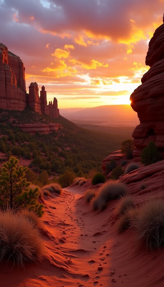
Brins Mesa Trail leaves from a trailhead a few miles northwest of Sedona and climbs gradually onto a broad mesa with 360-degree views. The red rocks here glow almost neon at sunrise and sunset when the light hits them at the right angle.
You’ll pass the Seven Sacred Pools about halfway up, a series of natural stone basins that hold water after rain. The trail sees fewer hikers than some of Sedona’s more famous routes, especially if you go early or late in the day.
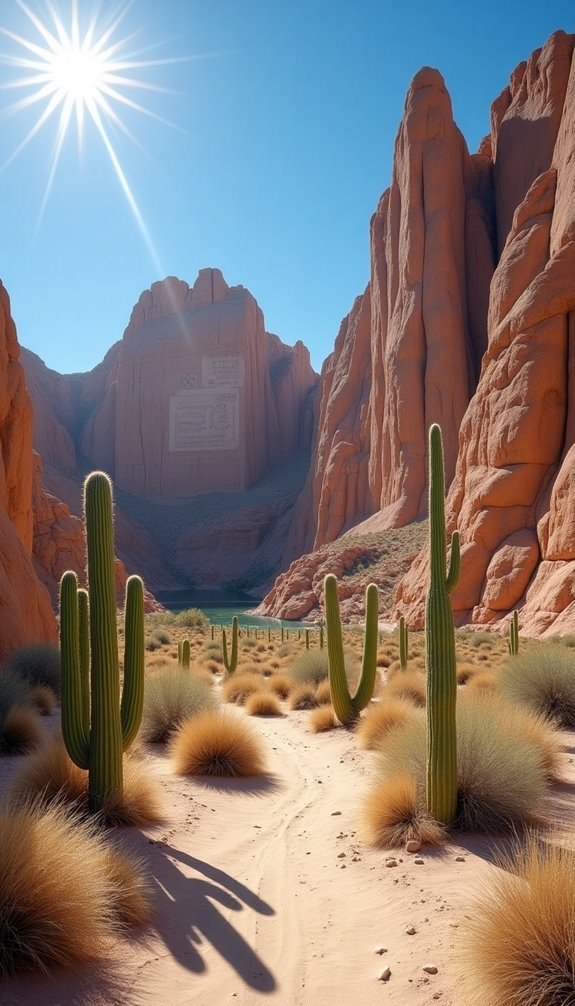
Kelso Dunes, Mojave Preserve: Experience Surreal Shifting Desert Landscapes
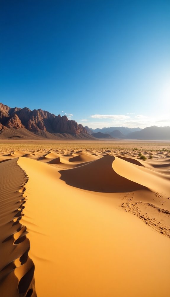
The Kelso Dunes rise 650 feet from the Mojave Desert floor, creating the third-tallest dune field in North America. Getting to the top is harder than it looks because you sink with every step, and the summit always seems farther away than it appears from the parking area.
If conditions are right and you slide down quickly, you might hear the dunes “boom,” a rare phenomenon caused by sand grains vibrating at the same frequency. Visit between October and April since summer temperatures regularly exceed 110 degrees, and bring at least twice as much water as you think you’ll need.